Basel city map: Grossbasel, Kleinbasel and the districts at a glance
How Basel is laid out: Grossbasel on the hill, Kleinbasel on the flat bank, the Messe to the north, the station to the south. The districts that matter to visitors, where the sights are and the walking distances a map will not tell you.
Basel is easy to read on a map: in the middle of the city the Rhine bends north and splits it into two halves. On the left is Grossbasel, with the Old Town on its hill; on the right is Kleinbasel on the flat bank, with the Messe further north.
Below the map we explain the districts, where the main destinations are and the distances people underestimate on a screen.
The map below is interactive. Tap a number for the name of the place, then Go for directions.
How is Basel laid out?
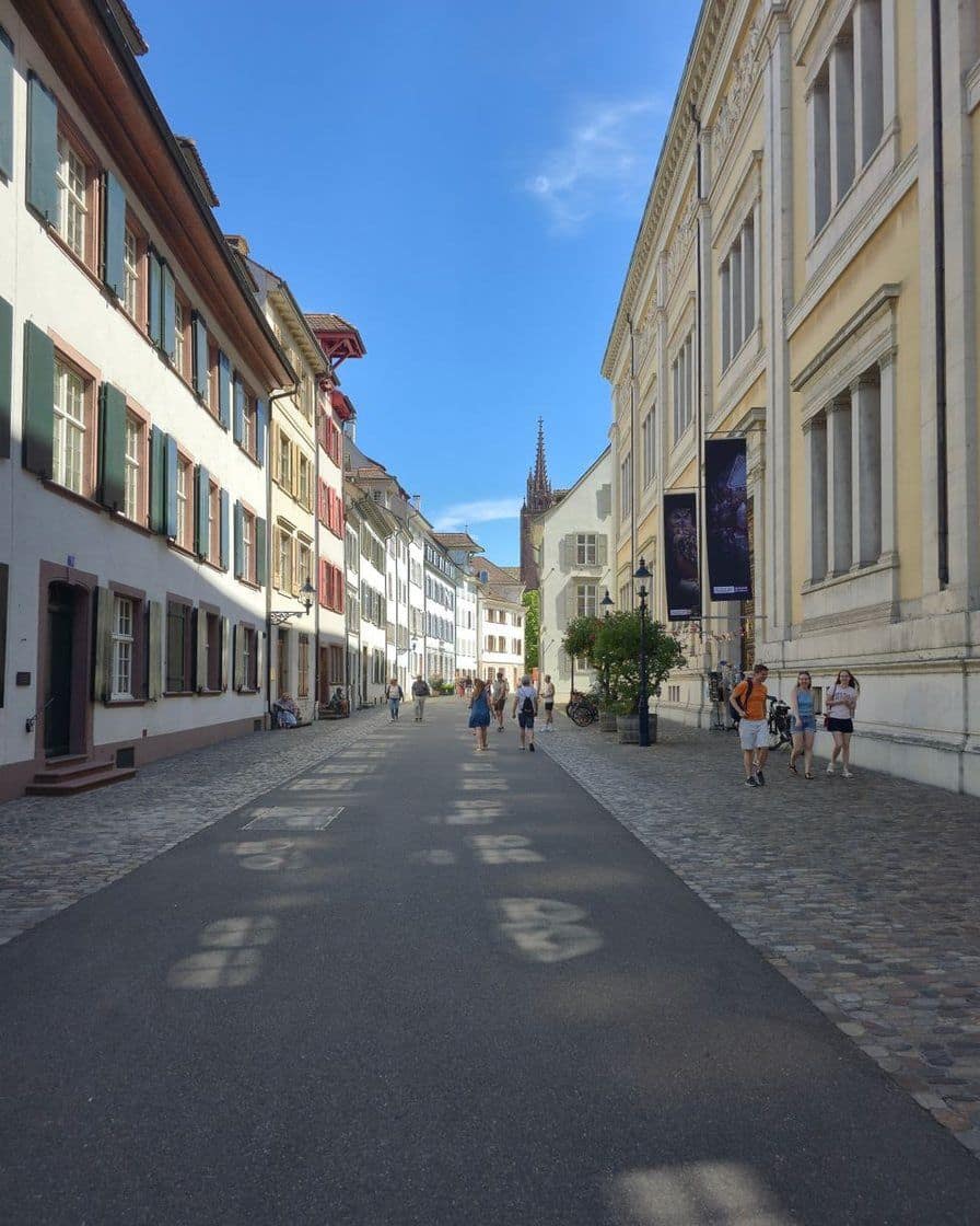
The heart of the city is the Rhine bend. On the higher left bank stands Grossbasel with the Minster, the Rathaus, Marktplatz and the lanes around Spalenberg. Opposite lies Kleinbasel, stretching along the bank and opening out towards Messeplatz and Badischer Bahnhof.
To the south, SBB station marks the edge of the centre, with Gundeldingen beyond it. To the north-west is St. Johann, with the Novartis Campus near the French border, and to the north-east the road leads to Riehen and the Fondation Beyeler.
Three countries meet here, and that shapes the map more than you might think. The airport is on French soil, Badischer Bahnhof belongs to the German rail network, and several tram lines end across the border.
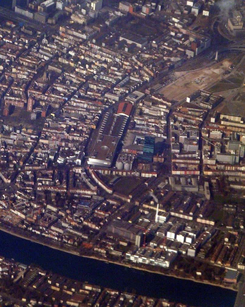
Photo: Brücke-Osteuropa, CC0, via Wikimedia Commons
Which districts should you know?
| District | Landmarks | For visitors | Watch out for |
|---|---|---|---|
| Grossbasel, Old Town | Barfüsserplatz, Marktplatz, Rathaus, Minster, Spalenberg | Historic core, lanes, Kunstmuseum, Minster | Cobbles and slopes, crowds around the market and the Minster |
| Kleinbasel | Claraplatz, Rheingasse, Kaserne, riverside | Restaurants, bars, promenade, local feel | Noisy at night, very mixed quality of venues |
| Messe, Matthäus | Messeplatz, Messe Basel, Clarastrasse | Art Basel, galleries, conference hotels | Prices and crowds much higher during fairs |
| St. Alban | Kunstmuseum, paper mill, city wall, riverside | Quiet, museums, architecture, walks | Few shops in the evening, uneven paths |
| Gundeldingen | SBB station, Meret Oppenheim-Platz | Hotels, restaurants, rail access | Transport hub, roadworks, lots of travellers |
| St. Johann | Novartis Campus, harbour, north-west riverside | Modern architecture, riverside path, changing neighbourhood | Uneven for visitors, some areas rather functional |
| Wettstein, Hirzbrunnen | Right bank, Messe, road to Riehen | Hotels, connections to Riehen | Few sights |
| Riehen | Fondation Beyeler, park, villas | The main cultural outing beyond the centre | No longer central Basel, tram ride needed |
The district profiles follow our research, and the district names on the map come from OpenStreetMap. Which district suits an overnight stay is compared, with prices, in our guide where to stay in Basel.
Use the map as a hotel filter: once you know whether the Old Town, the Messe or the station is the focus of your stay, choose by district rather than by the word "central". The places to stay in Basel in map view show their position relative to the Rhine and the tram lines, and the visitor tax adds the BaselCard for the tram.
Basel places to stay on the map →Partner link: booking through this link supports our editorial team at no extra cost to you.Where are the main sights?
- Minster and Pfalz: on the Minster hill in Grossbasel, looking across the Rhine to Kleinbasel. The Pfalz terrace is directly behind the choir.
- Rathaus and Marktplatz: at the foot of the hill, a few minutes from the Minster; you cannot miss the red town hall.
- Mittlere Brücke: the link between Marktplatz and Kleinbasel, with the Käppelijoch chapel in the middle.
- Spalentor: on the western edge of the Old Town, a surviving piece of the city wall, good at the end of a walk.
- Kunstmuseum: main building and new building on St. Alban-Graben, the Gegenwart site separately by the Rhine in St. Alban-Vorstadt. More on our page about the Kunstmuseum Basel.
- Museum Tinguely: on the right bank of the Rhine in Solitude Park. The Tinguely Fountain, by contrast, stands on Theaterplatz in Grossbasel; see Museum Tinguely.
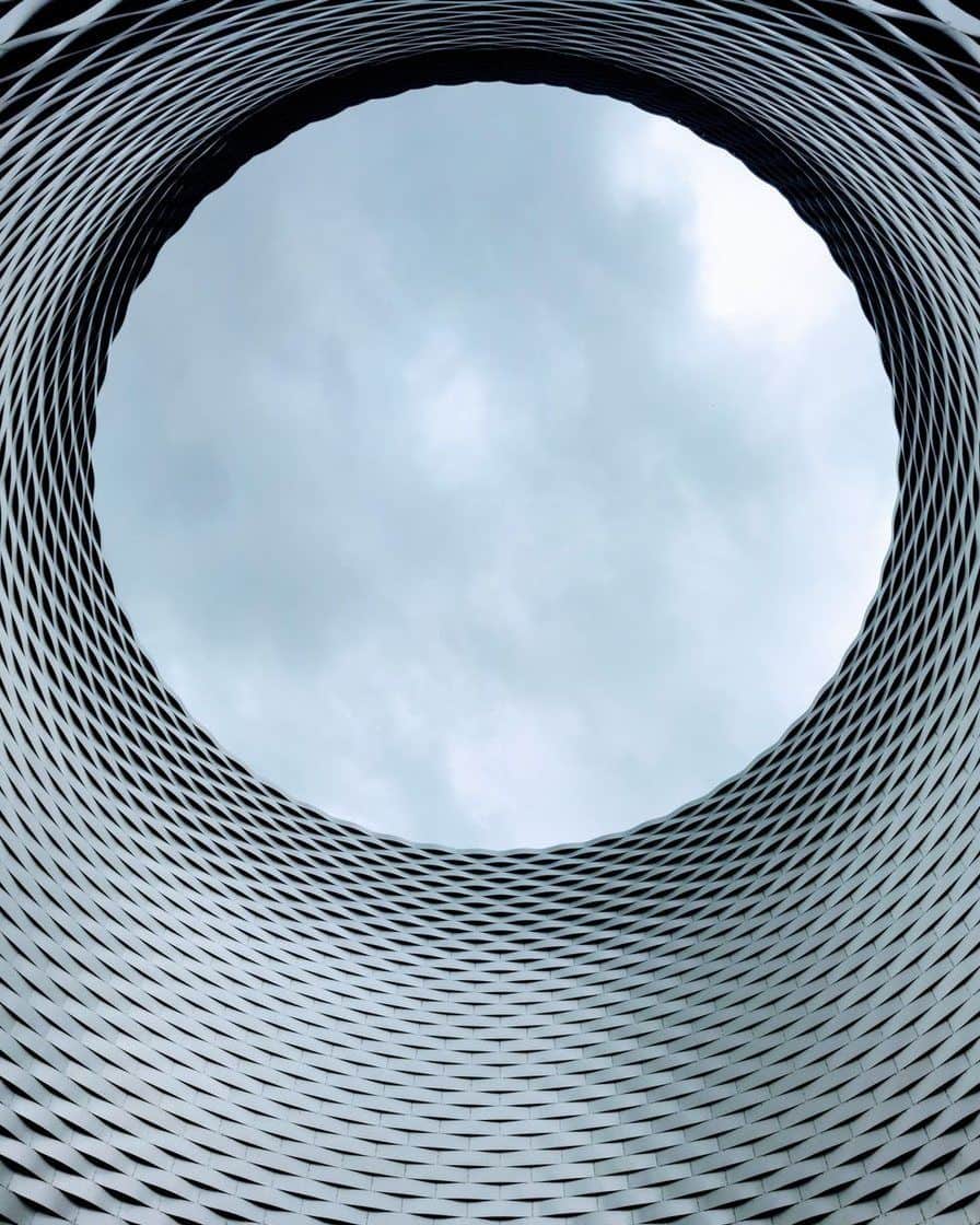
- Messe Basel: on Messeplatz in Kleinbasel, venue of Art Basel and part of the Herbstmesse.
- Fondation Beyeler: in Riehen, reached by tram 6; see Fondation Beyeler.
- Paper mill: in the St. Alban-Tal by the Rhine, on the way from the Kunstmuseum down to the river.
- Museum der Kulturen and Barfüsserkirche: both in the Old Town, the first on Münsterplatz, the second on Barfüsserplatz with the History Museum.
The places that are worth your time, with how long each takes, are in things to see in Basel.
Where are the three stations?
Basel has three stations, and on the map they sit at three corners. SBB station, with its French SNCF section, closes off the centre to the south; Badischer Bahnhof is in the north-east of Kleinbasel; and St. Johann station is in the north-west near the Novartis Campus.
If your ticket says "Basel", look closely: Basel SBB and Basel Bad Bf are not the same place, and 10 to 15 minutes of tram lie between them. Which trains stop where is explained in Basel's stations.
How do you cross the Rhine?
Over the bridges on foot or by tram, or on one of the four ferries that, according to the Basel ferry association (Fähri-Verein), run all year. They hang from a cable and move with the current alone; a crossing takes a few minutes.
Only the bridges are free; the ferry costs CHF 2 per crossing according to the ferry association. The Mittlere Brücke links Marktplatz with Kleinbasel, and the Wettsteinbrücke links the Kunstmuseum with the Wettstein district.
What can you visit on the Novartis Campus?
The campus in St. Johann is a corporate site with buildings by well-known architects, but it is not a public park. According to Novartis the grounds are open 7am to 7pm and closed on Saturdays, Sundays and public holidays.
The Novartis Pavillon opens 10am to 6pm, closed on Mondays, for 10 CHF, or 7.50 CHF with the BaselCard. On the map, the campus lies near St. Johann station and the French border.
How do you find your way around the Old Town?
The Old Town is a tangle of lanes, steps and squares, and phones tend to lose their position between the tall houses. Two fixed points help: the Minster on its hill and the Rhine, which is always to the north.
If you prefer a guide, book Basel Tourism's "Basler Altstadtgeschichten" tour: two hours for 25 CHF per person, 25 percent cheaper with the BaselCard. It passes the Rathaus, the Minster, the Barfüsserkirche and the Tinguely Fountain, and places are limited.
According to Basel Tourism, the sightseeing bus runs a loop of about two hours with twelve stops twice a day from Wednesday to Sunday. It is a good way to get your bearings at the start of a stay, and suits anyone who cannot walk far.
How far is it on foot?
On the map Basel looks tiny, and the Old Town is indeed easy to explore on foot. Cobbles, the slopes around the Minster and Spalenberg and the bridges do lengthen the walks noticeably, especially with luggage or a pushchair.
| Route | On foot | By tram |
|---|---|---|
| SBB station to Marktplatz | 17 minutes | 6 to 8 minutes, tram 8 or 11 |
| Barfüsserplatz to Messeplatz | 20 minutes | 7 to 8 minutes, tram 6, 14 or 16 |
| SBB station to Messeplatz | 26 minutes | 7 minutes, tram 2 |
| SBB station to Badischer Bahnhof | 35 minutes | 6 minutes on the S6, 9 to 10 on tram 2 |
| Badischer Bahnhof to Fondation Beyeler | too far | 12 minutes, tram 6 |
| SBB station to Fondation Beyeler | too far | 23 to 24 minutes, trams 2 and 6 or the S6 |
We calculated the walking times on OpenStreetMap; the ride times come from the timetable for Tuesday 27 October 2026 at 10am. Waiting, changes and the crush on fair days come on top, and the journey planner shows the exact connection.
What does a city map not show?
No map shows the Old Town cobbles, the kerbs at tram stops or the climb from Marktplatz to the Minster. For wheelchairs and pushchairs the route is therefore often longer than the line on the screen suggests.
An inventory of lifts, ramps and step-free routes for the whole Old Town is not published in our sources. The Fondation Beyeler describes its step-free entrances and lifts precisely, but such details are missing for many historic buildings.
The calendar changes the map too. During Fasnacht the Old Town belongs to the cliques, and during the Herbstmesse, from 24 October 2026 to 8 November 2026, fairground rides stand on Barfüsserplatz, Münsterplatz and Messeplatz. During Art Basel, from 17 June 2027 to 20 June 2027, Messeplatz is the most crowded spot in town.
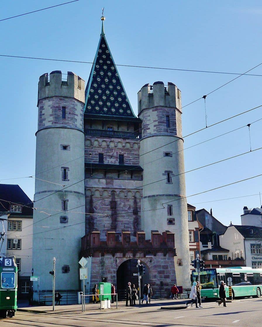
Photo: Zairon, CC BY-SA 4.0, via Wikimedia Commons
Which districts are worth a detour?
St. Alban is the quiet counterpart to the Old Town: the city wall, the paper mill in the St. Alban-Tal and a riverside path along the Rhine, with the Kunstmuseum at the top end. Shops and restaurants are thin on the ground, but it is ideal for a late-afternoon stroll.
Riehen belongs to the Canton of Basel-Stadt but is a separate municipality with its own village centre. Besides the Fondation Beyeler, it has the Berower Park and the Naturbad Riehen, which has its own opening hours and admission and is not part of the museum ticket.
Kleinbasel between Rheingasse and Kaserne is the district for evenings, with the riverbank as a summer meeting place. Gundeldingen behind the station, by contrast, is a residential and through district, of interest mainly for hotels and restaurants near the tracks.
How do you get from the centre into the region?
Basel is a good base for trips across the border, because the tram goes there. According to OpenStreetMap, line 8 ends in Weil am Rhein, home of the Vitra Campus, and line 3 at Gare de Saint-Louis in France.
These journeys need a separate ticket, as the BaselCard does not cover them. Zones, lines and fares are explained in getting around Basel, and which train stops at which Basel station is in Basel's stations.
Where do you park a car?
The parking guidance system divides the centre into three groups that match the map: Centre West for the Old Town, Centre North for the Messe and Kleinbasel, Centre South for the station and the Kunstmuseum. Which car parks have space right now is shown on Basel parking live.
Rates and blue-zone rules are in parking in Basel. For the Old Town the rule is simple: park on the edge and walk the rest, as the narrow lanes are no place to hunt for a space.
More room for longer stays: for a week or a family trip, a flat often gives you more space than a hotel room. The holiday flats in Basel can be filtered by district; check when booking whether the BaselCard for the tram is included.
See holiday flats in Basel →Partner link: booking through this link supports our editorial team at no extra cost to you.And if, after this first look at the map, you want a plan for your days, things to do in Basel has itineraries by time and interest.
Sources: research on the districts and sights (Fondation Beyeler, FAQ 2026, baselswitzerlandtours.com, myswitzerland.com), hotelsvetted.com and Basel Tourism for distances, travel.art for the SBB station to Messeplatz journey time, OpenStreetMap (district boundaries, points and tram lines, October 2026), Parkleitsystem Basel.
Frequently asked questions
What is the difference between Grossbasel and Kleinbasel?
Can you explore Basel on foot?
Where is Messe Basel?
How far is the Fondation Beyeler from the centre?
Corinne Schaub
Corinne spent six years on the front desk of a hotel near the Badischer Bahnhof, answering the same questions about trams, zones and the border every day. She writes the pages she would have liked to hand to her guests. She checks every fare with the operator, never in a guidebook.